

Key Takeaways
- The Americas contain extraordinary natural landscapes spanning deserts, rainforests, glaciers, and canyon systems.
- Each destination offers a distinct ecological and geological story worth understanding before you visit.
- Planning around seasonality and access conditions greatly improves the experience at most of these sites.
- Respecting local conservation rules helps preserve these landscapes for future generations of travelers.
A Continent-Spanning Mosaic of Wild Places
Few regions on the planet offer the sheer geographic variety found across North and South America. Within a single hemisphere, travelers can move from tropical rainforests dense enough to block sunlight, to ice fields that predate human civilization, to canyon systems carved over millions of years by patient rivers. What makes the Americas particularly compelling isn't just the scale of these landscapes - it's how radically different they are from one another, each shaped by distinct geology, climate, and ecology.
This list isn't about checking boxes. It's about understanding what makes each place genuinely unlike anywhere else, and why that distinction matters when you're deciding where to direct your time, energy, and curiosity.
Research Access Before You Book
Many of these landscapes sit within protected areas that require permits, timed entries, or advance reservations - particularly during high season. Check directly with the relevant national park authority or government tourism body well before your intended travel dates. Permit quotas can fill months in advance, and conditions on the ground change faster than most online guides are updated.
Landscapes Worth the Journey
The Patagonian Ice Fields, Chile and Argentina
Straddling the border between southern Chile and Argentina, the Patagonian Ice Fields represent the largest temperate ice mass in the Southern Hemisphere outside Antarctica. The Southern Patagonian Ice Field alone feeds dozens of glaciers, including the iconic Perito Moreno - one of the few glaciers in the world that is not currently in net retreat. The landscape is defined by violent contrasts: brilliant turquoise meltwater lakes sit at the base of jagged granite spires, and howling Patagonian winds reshape the sky by the hour.
Torres del Paine National Park and Los Glaciares National Park together offer the most accessible entry points, though "accessible" is relative - reaching either requires long travel days from major hubs. Seasonal timing matters enormously here; the austral summer (November through March) brings longer daylight hours but also the region's most unpredictable weather.
Perito Moreno is one of the few glaciers in the world not currently in net retreat.
The Amazon Basin, Brazil and Beyond
The Amazon River basin is the largest tropical rainforest on Earth, covering roughly 5.5 million square kilometers across nine countries, with Brazil holding the largest share. It produces an estimated 20 percent of the world's freshwater discharge into the ocean and supports an unparalleled concentration of biodiversity - millions of species, many still undescribed by science.
For travelers, the Amazon is less a single destination than a vast category of experiences. The Brazilian city of Manaus serves as a common gateway, sitting at the confluence of the Rio Negro and the Amazon itself, where the two rivers run side by side for several kilometers without fully mixing - a phenomenon locals call the Encontro das Águas, or Meeting of the Waters. Riverboat journeys deeper into the basin reveal a world operating on entirely different rhythms than the modern cities at its edges.
The Amazon supports millions of species, many still undescribed by science.
Utah's Canyon Country, USA
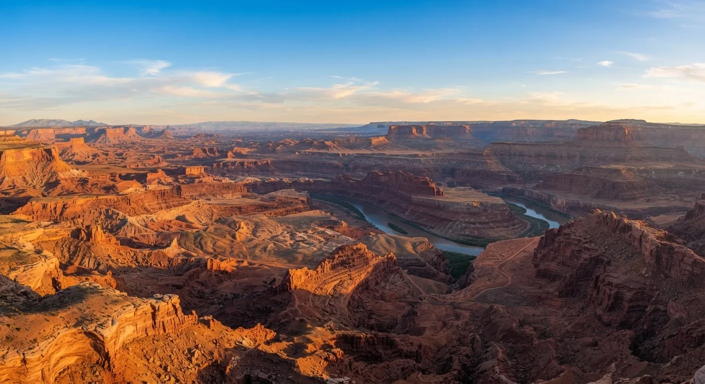
The Colorado Plateau in the American Southwest contains one of the most concentrated accumulations of canyon scenery anywhere on Earth. Carved primarily by the Colorado River and its tributaries over millions of years, the region encompasses the Grand Canyon, Zion, Bryce Canyon, Canyonlands, and Arches national parks within a few hours' drive of one another. The layered sedimentary rock tells a geological timeline stretching back hundreds of millions of years, each color band representing a different era of deposition.
What surprises many first-time visitors is the intimacy of the landscape alongside its grandeur - narrow slot canyons like Antelope Canyon, accessible near Page, Arizona, channel filtered desert light into colors that shift minute by minute. Most major sites require advance reservations or timed entry permits, particularly during peak spring and fall seasons.
The Colorado Plateau's layered rock tells a geological timeline hundreds of millions of years deep.
The Atacama Desert, Chile
The Atacama Desert, running along Chile's Pacific coast, is widely regarded as the driest non-polar desert on Earth. Certain weather stations in its core have recorded decades without measurable rainfall. Yet the Atacama is far from lifeless or visually monotonous. Salt flats, volcanic peaks, geothermal fields, and - during rare rainfall years - vast blooms of desert wildflowers called desierto florido create a landscape of startling variety.
The high-altitude altiplano near San Pedro de Atacama hosts flamingos wading in shallow salt lakes at elevations above 4,000 meters, an image that defies easy categorization. The region's extreme aridity and minimal light pollution have also made it one of the premier destinations on Earth for stargazing - several major international observatories operate in the area.
Certain Atacama weather stations have recorded decades without measurable rainfall.
The Florida Everglades, USA
Often described as a "river of grass," the Florida Everglades is a slow-moving freshwater system flowing southward across the tip of the Florida peninsula into Florida Bay. Covering approximately 1.5 million acres within Everglades National Park, it is the largest subtropical wilderness in the United States and a UNESCO World Heritage Site. The ecosystem supports an extraordinary mix of species - American alligators, manatees, roseate spoonbills, and more than 350 species of birds.
What distinguishes the Everglades from many wilderness destinations is its accessibility: much of the park can be experienced by car, kayak, or guided airboat tour. Winter months (roughly November through April) bring drier conditions, lower humidity, and the best wildlife viewing opportunities as animals congregate around shrinking water sources.
The Everglades is the largest subtropical wilderness in the United States.
The Canadian Rockies, Alberta and British Columbia
Banff and Jasper national parks in Alberta anchor one of North America's most dramatic mountain landscapes. Glacially carved valleys, impossibly blue glacier-fed lakes - Moraine Lake and Lake Louise among the most photographed - and wildlife corridors supporting grizzly bears, wolves, and elk make this region a benchmark for mountain scenery on the continent. The Icefields Parkway, a 232-kilometer highway connecting the two parks, is frequently cited as one of the most scenic drives in the world.
The Canadian Rockies also receive significant visitation, and popular sites like Moraine Lake now require shuttle reservations during peak summer months rather than private vehicle access. Planning ahead is essential - but the reward is a landscape where the scale of the mountains consistently exceeds expectations, even for experienced travelers.
The Icefields Parkway is consistently cited among the world's most scenic drives.
A Note on Seasonality and Safety
Each of these destinations has a season window that makes visits significantly safer and more rewarding. Patagonia's weather is notoriously volatile year-round; the Amazon basin experiences dramatic flood and dry seasons that affect access and wildlife visibility; desert sites can be dangerously hot in summer. Always review current travel advisories, entry requirements, and safety guidance from official government sources before finalizing plans.
Traveling These Landscapes Responsibly
Many of the destinations described here sit within protected national parks, indigenous territories, or UNESCO World Heritage Sites. Entry fees, permit systems, and regulated guide requirements exist not to inconvenience travelers but to manage the real pressure that tourism places on fragile ecosystems. Before visiting any of these places, verify current access conditions, permit availability, and any seasonal closures directly with official park or government sources - conditions change, and information found in guidebooks or travel blogs can quickly become outdated.
The reward for doing that homework is a richer experience: knowing you're moving through a landscape that's actively being protected means you're part of a longer story, not just a momentary visitor.